Incomprehensibly, gigantically, stunningly beautiful. I could go on.
But neither words, nor images can come close to experiencing the Grand Canyon first hand. I am just so glad I got to see it and I’m sure that I’ll be back there one day soon for some proper hiking and camping.
Georgie and I went on three hikes (not counting the walk to Shoshone Point, even though that is probably the best view of the Canyon from the South Rim that we came across!) and I just wanted to share them with you here, along with the GPS data from my Garmin Forerunner.
And if you’d like to see more photos from the trip – they’re over on my Flickr page.
Bright Angel Trail to the Indian Garden Campground

The most popular hike in the Canyon, probably as it’s so easily accessible from Grand Canyon Village and burros are available to take you down and up (we decided to walk!). Also our longest hike of the three, we made it to the Indian Garden before turning around for the hike out. Totally knackered after that ascent!

8.5 miles
3 hours, 22 minutes
2,986 feet from highest to lowest point on our hike
Hermit’s Rest to Dripping Springs

A stunning hike with some spectacular views and a surprising amount of trees and shade. Also, the descent flattens out after 1.3 miles and 1,364 feet.

6 miles
3 hours, 10 minutes
1,542 feet from highest to lowest point on our hike
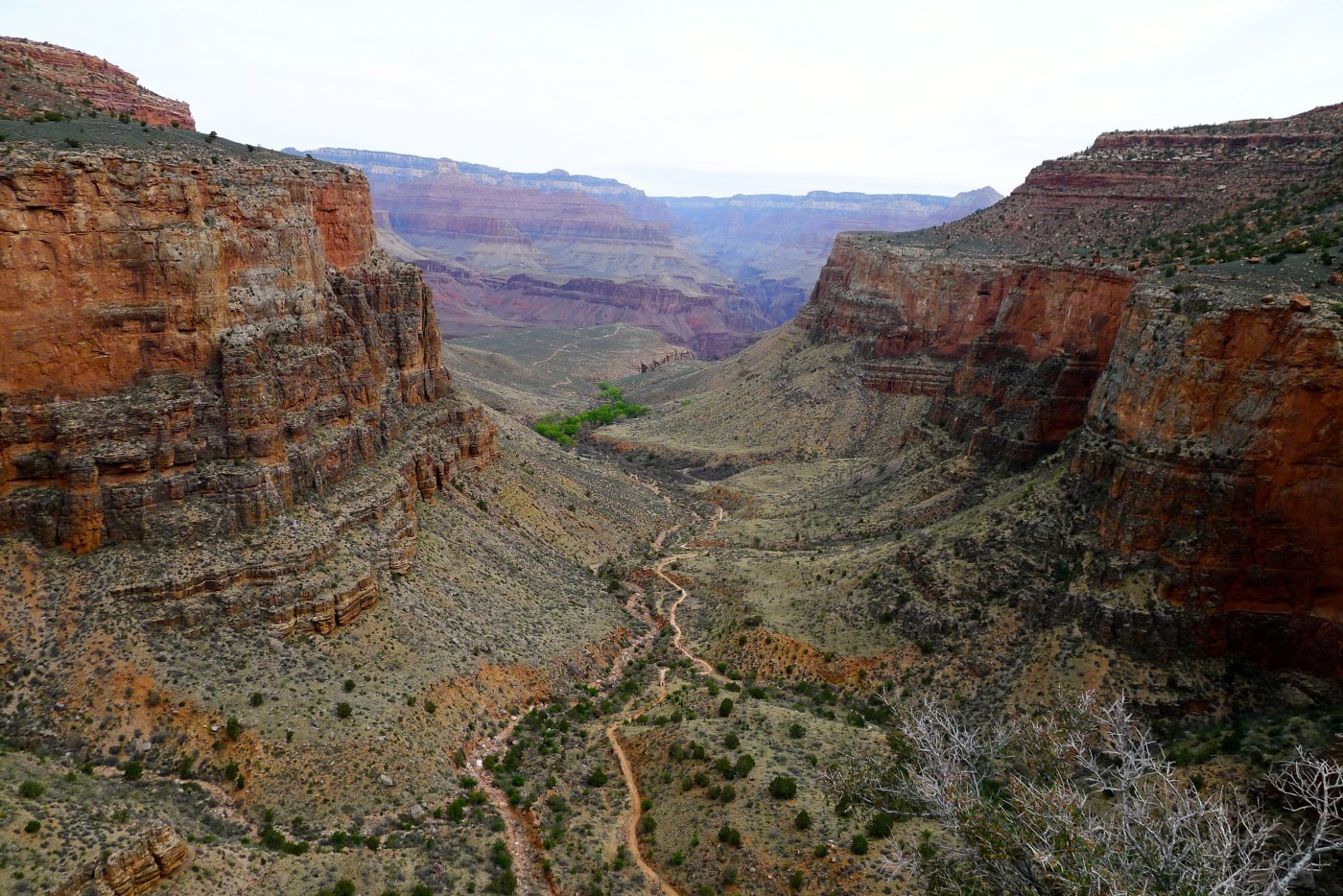
Grandview Point to Horseshoe Mesa

Probably my favourite trail of the three. Accessible from the aptly named Grandview Point, Horseshoe Mesa is ‘only’ a three mile hike away from the trail head. The first of those three miles was probably the most difficult stretch of trail we experienced. It gets a little less steep after that, but there quite a few boulders we had to scramble over. All really good fun!
As with Dripping Springs, we didn’t actually make it to our final destination (we didn’t want to overdo it on our first trip to the Canyon) but that doesn’t mean we enjoyed them any less.
 4.1 miles
2 hours, 37 minutes
2,006 feet from highest to lowest point on our hike

1 Pingback